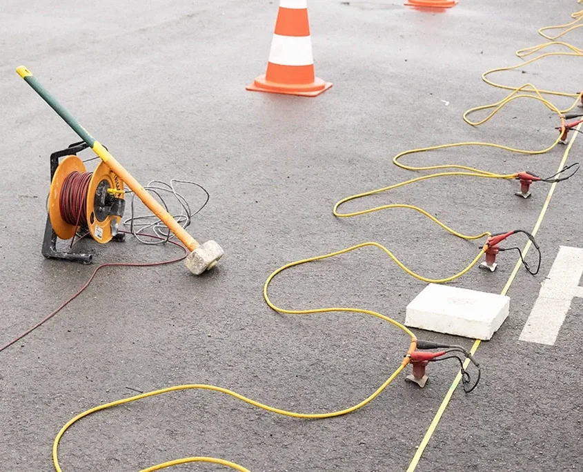
A 24-channel Geometrics Geode system with 4.5 Hz vertical geophones is deployed across Barrie job sites to generate high-resolution velocity cross-sections. The array connects to a buffalo gun or accelerated weight drop source depending on depth requirements and municipal noise constraints. In Barrie, this equipment must resolve the Paleozoic limestone-shale contact west of Kempenfelt Bay while also penetrating the thick glacial till in the city’s eastern neighborhoods near the Simcoe County Museum. The geophone spread is typically laid at 2-meter intervals, though tighter spacing is common near the Allandale waterfront where buried valleys create abrupt velocity contrasts. Each shot gather passes through first-break picking and iterative inversion routines before the final tomogram is delivered. For projects requiring combined stratigraphic and strength data, the field crew often coordinates with SPT drilling teams to correlate seismic velocities with N-values, and in areas of soft organic silts near the lake, we integrate results with CPT testing to refine liquefaction susceptibility models.
Velocity contrasts of 400 m/s versus 2200 m/s within 20 lateral meters—that’s the difference between over-excavating blindly and placing footings with confidence.
Process overview
Local context
The contrast between Barrie’s north and south ends is stark. South of Ardagh Bluffs, the Simcoe Uplands expose limestone bedrock within a meter of surface, offering high seismic velocities above 2500 m/s and negligible site amplification. But drive north toward the former Allandale rail yards, and you encounter 20 meters of soft glaciolacustrine clay where Vs30 can dip below 180 m/s—a Site Class E profile by NBCC definitions. Developers who assume uniform conditions across the city run into trouble: a footing design optimized for till in Holly fails in the compressible soils of Painswick. Seismic tomography crosses this divide by mapping the bedrock surface continuously, flagging the transition from stiff diamict to sensitive clay. Missing that transition means differential settlement, cracked partition walls, and costly underpinning. On slopes above Kempenfelt Bay, the same velocity data feeds into slope stability analysis to identify weak layers that daylight near the shoreline.
Relevant standards
ASTM D5777-18, NBCC 2015 Part 4, Ontario Building Code O. Reg. 332/12
Additional services
Refraction Tomography
P-wave first-arrival tomography for mapping bedrock depth, rippability, and lateral velocity variations in glacial overburden. Compliant with ASTM D5777.
MASW and Vs Profiling
Surface wave acquisition and dispersion analysis to derive 1D and 2D shear wave velocity profiles. Used for NBCC site classification (A through E) and liquefaction screening.
Crosshole Seismic Testing
Borehole-to-borehole P- and S-wave velocity measurement with 0.5 m depth resolution. Ideal for deriving dynamic elastic modulus in critical infrastructure foundations.
Downhole Seismic Logging
Single-borehole velocity logging using a triaxial geophone array. Provides interval velocities and Poisson’s ratio for soil and rock layers encountered during drilling.
Typical parameters
Top questions
How deep can seismic refraction see in Barrie’s glacial till?
With a 115-meter spread and an accelerated weight drop source, we routinely image 30 to 40 meters depth in the dense sandy till common around Barrie. Penetration decreases if the upper few meters are frozen, so winter surveys may require longer spreads or a larger energy source. For depths beyond 40 meters, we recommend combining refraction with a few calibration boreholes.
Can you do a seismic survey on a busy commercial lot in Barrie?
Yes. We use a weight drop source rather than explosives on urban and commercial sites, which eliminates permitting delays. The geophone spread can be laid on asphalt or concrete using coupling plates. Noise from nearby traffic is handled by stacking multiple shots at each source location until ambient noise cancels out—this is standard practice for surveys along Mapleview Drive or near Highway 400.
What does seismic tomography provide that a borehole alone cannot?
A borehole gives you a point measurement. Tomography gives you a continuous 2D cross-section between two points, capturing lateral changes in velocity that a borehole would miss entirely. In Barrie’s drumlinized terrain, a buried valley or a limestone pinnacle can be 10 meters away from a borehole and go undetected. The continuous image reduces the risk of surprises during excavation.
How do you classify the seismic site class in Barrie?
We measure the average shear wave velocity in the upper 30 meters (Vs30) using MASW or downhole logging. The value determines the NBCC site class: rock sites with Vs30 above 1500 m/s are Class A, stiff till sites between 360 and 760 m/s fall into Class C, and soft clay sites below 180 m/s are Class E. This classification directly affects the seismic design forces in your structural calculations.
What’s the typical cost for a refraction survey in the Barrie area?
Most refraction tomography projects in Barrie fall between CA$3,340 and CA$8,210, depending on the number of lines, array length, and source type. A single 69-meter line for a residential lot is at the lower end, while a multi-line commercial survey with crosshole or downhole add-ons reaches the upper range. We provide a fixed-price proposal after reviewing your site plan and geotechnical objectives.