A graded site on the Oro Moraine last spring had us running limit-equilibrium models before the first footing was poured. The owner wanted a walkout basement facing Kempenfelt Bay, but the 18-degree slope and the silty sand over dense clay till told a different story. We ran Spencer and Morgenstern-Price slices on the cross section and found a rotational failure surface that daylighted right through the proposed building pad. That is the reality of slope stability analysis in Barrie—Lake Simcoe’s shoreline, the Lovers Creek ravine system, and the drumlinized till plains create ground profiles that cannot be generalized. A desktop review of surficial geology maps is never enough; you need borehole shear strengths, piezometric levels from spring melt, and a factor of safety that accounts for snowmelt recharge. When the stratigraphy involves varved clays or the Sunnybrook Drift, we pair the slope model with in-situ permeability measurements to track transient pore pressures that knock the FoS below 1.3 in April.
A slope stability model is only as good as the pore-pressure assumption: in Barrie, the April water table can reduce the factor of safety by 30 percent compared to August conditions.
Process overview
Local context
The freeze-thaw cycle in Barrie is the hidden variable that ages a slope. From November to March, the upper 1.2 m of the clay-rich till can freeze solid, creating an impermeable cap. When the March thaw arrives, meltwater ponds behind that cap and saturates the silty layer underneath, generating positive pore pressures that persist for weeks. A slope that stood at FoS 1.4 in September can drop to 1.05 in early April, and that is when we see surface sloughing on the Lake Simcoe bluffs near Minet’s Point. Our analysis builds in a seasonal sensitivity case: we run the same cross section with the water table at the ground surface, which is the regulatory requirement under the Lake Simcoe Region Conservation Authority for development within the regulated area. If the factor of safety dips below unity, we do not just flag the risk; we size anchors or drainage measures until the model holds. The 2019 high-water event on Lake Simcoe, when the lake level reached 219.32 m, showed that shoreline recession is not a slow process—it happens in pulses during wet years, and a slope stability analysis that ignores the lake’s influence on toe erosion is incomplete.
Relevant standards
Canadian Foundation Engineering Manual (CFEM) 2006 – limit equilibrium methods and acceptance criteria, National Building Code of Canada (NBCC) 2015 – seismic hazard and geotechnical site classification, Ontario Building Code (OBC) 2012 – reference to CFEM for slope stability, ASTM D4767 – consolidated-undrained triaxial compression test for effective stress parameters, Lake Simcoe Region Conservation Authority – development regulation and slope hazard mapping
Additional services
Rotational and Translational Stability Modeling
We build two-dimensional limit-equilibrium models in Slide2 or Slope/W using site-specific stratigraphy from boreholes. Each model includes circular and non-circular failure searches, drained and undrained strength envelopes, and a seasonal sensitivity run with the water table at surface elevation.
Pore-Pressure Instrumentation and Monitoring
Standpipe and vibrating-wire piezometers installed in the critical slope section, read monthly through one full hydrologic year. The data feeds directly into the stability model to replace assumed phreatic surfaces with measured ones, often improving the FoS by 0.2–0.4 compared to conservative assumptions.
Seismic Slope Stability Screening
Pseudo-static analysis using the NBCC 2015 seismic hazard values for Barrie (Sa(0.2) and PGA). We apply a horizontal seismic coefficient kh consistent with CFEM recommendations for permanent slopes and report the yield acceleration and displacement estimate where the pseudo-static FoS falls below 1.0.
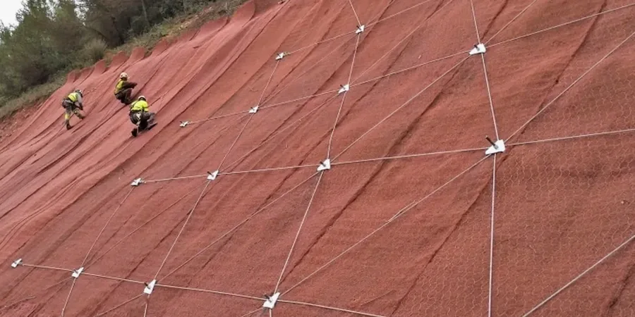
Reinforcement and Remedial Design
When the computed factor of safety is below the target, we design the intervention—soil nailing, ground anchors, drainage buttresses, or regrading—and run the model again to demonstrate compliance. The deliverable is a stamped design brief and construction cross-section ready for the permit application.
Typical parameters
Top questions
What slope stability analysis methods does the Ontario Building Code accept for a Barrie building permit?
The OBC references the Canadian Foundation Engineering Manual (CFEM 2006), which accepts limit-equilibrium methods—Spencer, Morgenstern-Price, and Bishop—for rotational and translational failure assessment. The City of Barrie building department reviews slope stability reports against the CFEM criteria: minimum factor of safety 1.5 for permanent cuts under static conditions, and 1.1 for the pseudo-static seismic case using NBCC 2015 ground-motion parameters. For sites within the Lake Simcoe Region Conservation Authority regulated area, the authority may also require a seasonal high-water case (phreatic surface at ground level) and a toe-erosion scenario. We deliver a stamped report with the critical cross-section, input parameters, and computed FoS for each required case.
How much does a slope stability analysis cost for a single-family lot in Barrie?
For a typical single-family lot on a 10–25% grade in Barrie, a slope stability analysis ranges from CA$1,890 to CA$5,470. The spread depends on whether existing borehole data can be used or if a new geotechnical drilling program is needed, the number of cross-sections required by the conservation authority, and whether seasonal piezometer monitoring is part of the scope. A straightforward cut-and-fill analysis with one cross-section and no instrumentation falls at the lower end; a shoreline property with lake-level influence, multiple sections, and reinforcement design moves toward the upper end.
What triggers a slope stability assessment requirement in Barrie?
Three triggers are common: a site within the Lake Simcoe Region Conservation Authority regulated area (typically within 30 m of the shoreline or a valley feature), a proposed cut or fill exceeding 1.5 m in height, or a grading plan that creates a slope steeper than 3H:1V. The City of Barrie site plan review checklist flags slopes greater than 10% for geotechnical review, and the building official may request a slope stability analysis as a condition of permit issuance. We coordinate with the conservation authority early to agree on the analysis cases before fieldwork starts.
How long does the slope stability investigation and reporting take in Barrie?
A typical timeline is four to six weeks from mobilization to stamped report. Week one: borehole drilling and Shelby tube sampling. Weeks two and three: laboratory triaxial and index testing. Week four: limit-equilibrium modeling and sensitivity runs. Week five: report drafting, internal peer review, and stamping. If piezometer monitoring is required, the analysis may be staged—an interim report based on assumed groundwater is submitted for permit, and a final report with measured pore pressures follows after six to twelve months of readings. Winter drilling on frozen clay till can add a week due to frost penetration and casing requirements.